 Photo: Michael J Fromholtz · CC BY-SA 4.0
Great Ocean Road
Follow Victoria’s southern edge from Melbourne to Port Fairy, trading quick photo stops for cliff walks, cool-forest detours and two nights by the sea.
- Allow
- 3–5 days
- Route
- 371 km
- Drive time
- 5 hr 11 min
- Stops
- 6
The Great Ocean Road is famous for one limestone viewpoint, but its best rhythm comes earlier: salt in the air at Torquay, fern gullies behind Lorne, koala country around Cape Otway and the soft evening light that arrives after the day-trip coaches leave Port Campbell.
Three days is the minimum that feels like a journey rather than a checkpoint run. Four or five lets you walk, swim when conditions allow, and continue to Port Fairy instead of turning around at the Twelve Apostles.
The road, in one glance
Pinch or scroll with Ctrl / ⌘ to zoom
Drawing the route…
The route earns
its distance
Each pin is selected as a place to do something—not merely proof that you passed through.
- 01Melbourne
- 02Torquay & Bells Beach
- 03Lorne
- 04Apollo Bay & Cape Otway
- 05Twelve Apostles & the Shipwreck Coast
- 06Port Fairy
 Photo: Melbpal · CC BY-SA 4.0
Melbourne
Begin with coffee, provisions and an unhurried exit from the city; the road earns its drama after Geelong rather than on the motorway.
Melbourne ( MEL-bərn, locally; Boonwurrung/Woiwurrung: Narrm or Naarm) is the capital and most populous city of the Australian state of Victoria and the second-most populous city in Australia. The city's name generally refers to a 9,993-square-kilometre (3,858 sq mi) area, comprising an urban agglomeration of 31 local government areas.
 Photo: Ameins at English Wikipedia · Public domain
Torquay & Bells Beach
Australia’s surf industry grew up here. Walk the clifftop at Bells Beach, watch the sets roll in and let Torquay mark the moment the road trip properly begins.
Torquay ( tor-KEY) is a town in Surf Coast Shire, Victoria, Australia, which faces Bass Strait, 21 km south of Geelong and is the gateway to the Great Ocean Road. It is bordered on the west by Spring Creek and its coastal features include Point Danger and Zeally Bay. At the 2021 census, Torquay had a population of 18,534.
 Photo: Hagai Agmon-Snir حچاي اچمون-سنير חגי אגמון-שניר · CC BY-SA 4.0
Lorne
A green amphitheatre between the Otways and the sea, with a walkable foreshore, strong lunch options and waterfalls tucked just inland.
Lorne is a town in Surf Coast Shire, Victoria, Australia. It is situated on the Louttit Bay and Erskine River and is a popular destination on the Great Ocean Road. At the 2016 census Lorne had a population of 1,114.
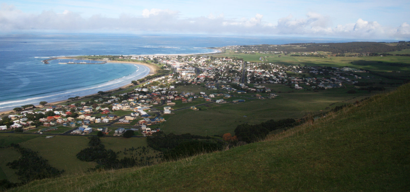 Photo: Marcus Wong Wongm · CC BY-SA 3.0
Apollo Bay & Cape Otway
Turn briefly away from the ocean for giant ferns, rainforest walks and the Cape Otway headland, then return for a harbour-town evening.
Apollo Bay is a coastal town in southwestern Victoria, Australia. It is situated on the eastern side of Cape Otway, along the edge of the Barham River and on the Great Ocean Road, in the Colac Otway Shire. The town had a population of 1,790 at the 2021 census.
Photo: Michael J Fromholtz · CC BY-SA 4.0Twelve Apostles & the Shipwreck Coast
The road’s cinematic finale is a sequence, not one platform: Gibson Steps, the stacks, Loch Ard Gorge and the quieter formations west of Port Campbell.
The Twelve Apostles are a collection of limestone stacks off the shore of Port Campbell National Park, by the Great Ocean Road in Victoria, Australia. Their proximity to one another has made the site a popular tourist attraction. Despite their name, it is possible that there were never 12 rock stacks.
 Photo: jjron · GFDL 1.2
Port Fairy
Finish among bluestone cottages, a working harbour and the easy circuit around Griffiths Island — a gentler ending than a motorway U-turn.
Port Fairy (historically known as Belfast) is a town in south-western Victoria, Australia. It lies on the Princes Highway in the Shire of Moyne, 28 kilometres (17 mi) west of Warrnambool and 290 kilometres (180 mi) west of Melbourne, at the point where the Moyne River enters the Southern Ocean.
Drive the conditions,
not the itinerary.
Drive west so your passenger side stays closest to the ocean. Avoid racing back to Melbourne after sunset; wildlife and fatigue make the inland return a poor final chapter.
Checked against
the people who run it
Distances and driving times are planning estimates. Conditions, closures, ferries, permits and park rules can change, so check the linked official guidance before setting out.