 Photo: Ek2030372672 · CC BY-SA 4.0
Red Centre Way
Circle from Alice Springs through the West MacDonnell Ranges, Watarrka and Uluṟu–Kata Tjuṯa with enough time for dawn walks and dark-sky evenings.
- Allow
- 6–8 days
- Route
- 1,377 km
- Drive time
- 14 hr 16 min
- Stops
- 5
The Red Centre is measured less by kilometres than by light, heat and the space between services. Alice Springs, Tjoritja, Watarrka and Uluṟu–Kata Tjuṯa form a powerful circuit, but only when the itinerary leaves room for early walks, cultural interpretation and long, quiet evenings.
This version follows sealed-road connections suitable for a conventional rental car. The shorter Mereenie Loop alternative has separate permit, vehicle and road-condition questions and should never be assumed to be included in a rental agreement.
The road, in one glance
Pinch or scroll with Ctrl / ⌘ to zoom
Drawing the route…
The route earns
its distance
Each pin is selected as a place to do something—not merely proof that you passed through.
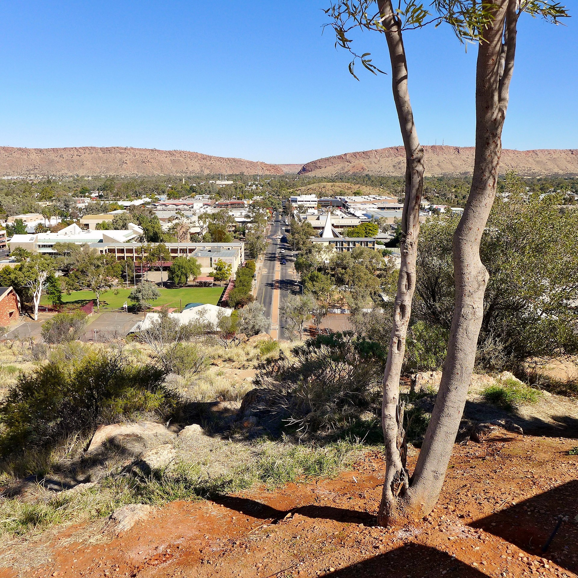 Photo: Bahnfrend · CC BY-SA 4.0
Alice Springs
The practical and cultural anchor of the route: stock the car, understand current conditions and make time for the region’s art and desert ecology.
Alice Springs (Eastern Arrernte: Mparntwe,, colloquially in English The Alice or Alice) is a town in the Northern Territory, Australia; it is the third-largest settlement in the Northern Territory after Darwin and Palmerston. The name Alice Springs was given by surveyor William Whitfield Mills after Alice, Lady Todd (née Alice Gillam Bell), wife of the telegraph pioneer Charles Todd.
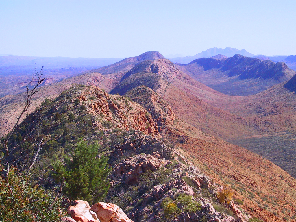 Photo: No machine-readable author provided. Boticario assumed (based on copyright claims). · Public domain
Tjoritja / West MacDonnell Ranges
Red quartzite walls, cool gaps and waterholes interrupt the desert west of Alice, rewarding a full day rather than a token roadside pause.
Tjoritja / West MacDonnell is a national park in the Northern Territory (Australia) due west of Alice Springs and 1234 km south of Darwin. It extends along the MacDonnell Ranges west of Alice Springs. The popular extended walk, the Larapinta Trail, runs east–west along the linear park, following the West MacDonnell Ranges.
 Photo: Zoharby · CC BY-SA 3.0
Watarrka / Kings Canyon
Sandstone domes and sheer canyon walls make the Rim Walk one of the circuit’s defining mornings, with shorter valley options when heat or mobility changes the plan.
Kings Canyon, known traditionally as Watarrka, is a deep sandstone gorge at the western end of the George Gill Range inside Watarrka National Park. Sheer red walls shelter cycads and permanent waterholes below, while the exposed Rim Walk climbs above the canyon to weathered domes and broad desert views.
Photo: Ek2030372672 · CC BY-SA 4.0Uluṟu
Walk at the rock’s base with Aṉangu context, noticing waterholes, geology and stories that a distant sunset photograph cannot carry on its own.
Uluru (; Pitjantjatjara: Uluṟu ), also known as Ayers Rock ( AIRS) and officially gazetted as Uluru / Ayers Rock, is a large sandstone monolith. It crops out near the centre of Australia in the southern part of the Northern Territory, 335 km (208 mi) south-west of Alice Springs. Uluru is sacred to the Pitjantjatjara, the Aboriginal people of the area, known as the Aṉangu.
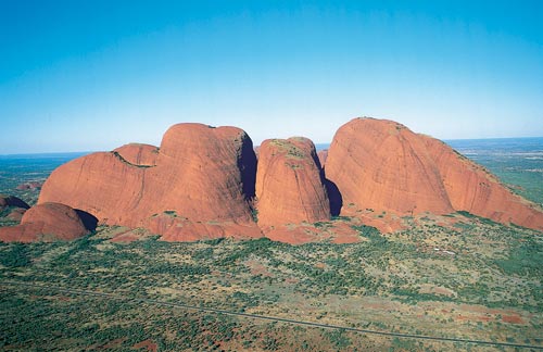 Photo: Tourism NT · Attribution
Kata Tjuṯa
The domes feel wilder and more enveloping than they appear from afar; the Valley of the Winds reveals the scale slowly and on foot.
Kata Tjuṯa, also known as The Olgas and officially gazetted as Kata Tjuta / Mount Olga, is a group of large, domed rock formations or bornhardts located about 360 km (220 mi) southwest of Alice Springs, in the southern part of the Northern Territory, central Australia. Uluṟu / Ayers Rock, located 25 km (16 mi) to the east, and Kata Tjuṯa / The Olgas form the two major landmarks within the Uluṟu-Kata Tjuṯa National Park.
Drive the conditions,
not the itinerary.
Fuel early, carry water, avoid dusk and night driving, and check every day’s road and park conditions. Remote does not mean empty of rules or responsibility.
Checked against
the people who run it
Distances and driving times are planning estimates. Conditions, closures, ferries, permits and park rules can change, so check the linked official guidance before setting out.